MTBSlovenia.net

home

trail list

help

site map

slovensko   english

EASY


Kurescek

  28 km   788 m   1:45 h

 panorama

 skills

 orientation

 aerobic

ooooooo

ooooooo

ooooooo

ooooooo

Slovenia


foto1


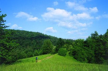
 Meadows, cart tracks and forests (8.20 km, 637 m)

 >> enlarge


foto2


There is a nice view over Ljubljana and its surroundings 

towards the top (12.52 km, 686 m)

 >> enlarge


opis

DESCRIPTION

-->

foto

PHOTOS  

skica

TRAIL MAP

PROFILE

kazipot

ROAD BOOK


 INFO

 Starting point


 Length

 Riding time

 Total ascent


 Starting height

 Max height

 Cyclability


Ig


28.02 km

1 h 45 min

788 m


324 m

833 m

100 %

 TERRAIN

 Singletrack

 Cart track

 Macadam

 Asphalt


0.6 km

12 km

10.4 km

5 km

 MAPS

 DTK

 AS


no. 135 

page 147 


top of page | homesite map

slovensko 


11. januar 2004 

Copyright © Marjan Tkavc